Grid Elevation of Reference Seam (Roof, Floor or Mid-Point)
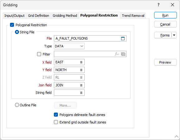
Click the Polygonal Restriction tab.
Use the Reference Seam Elevation file and choose RL as the Grid field. For the Grid Limits, define a suitable X and Y block size (normally the same value).
Set the Gridding Method to Kriging and, for the Model parameters, choose the saved (elevation) semi-variogram form.
As a rule of thumb the data search should be about 75% of the Range established by the semi variogram.
Since a fault has been identified, use the Polygonal restriction option to define the Fault Zones. Select the “Polygons delineate fault zones” check box. With this enabled, cells falling inside any polygon will only use points inside that polygon in the gridding process.
Select Exact interpolation, to honour the data (this already controlled to some extent by setting Nugget to zero. However this will only fully honour the data if a point of observation is very close to the centre of the cell being modelled).
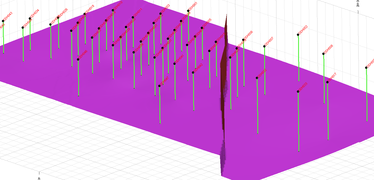
The elevation grid can be visually validated by displaying it in Vizex.
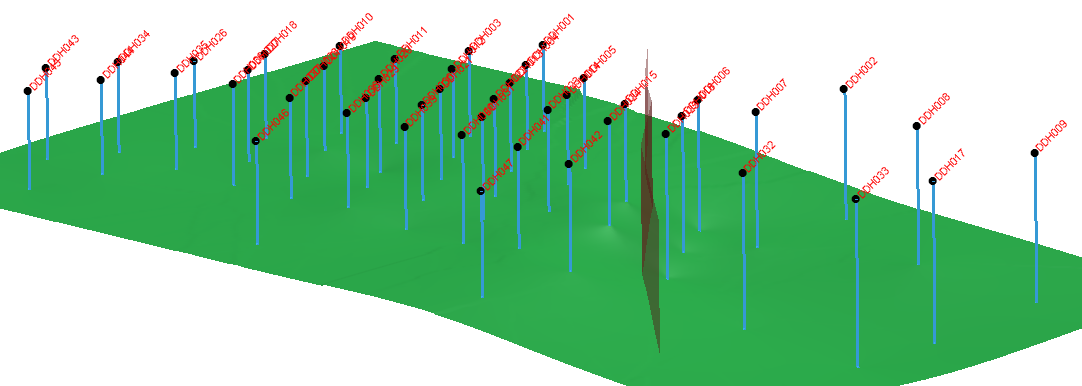
The above grid uses the same parameters except that Polygonal restriction is turned off.