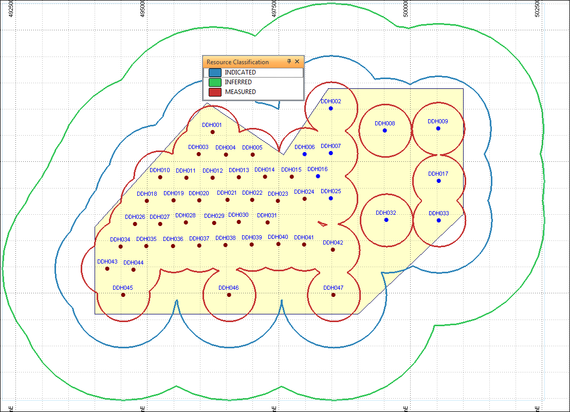
Generate Resource Classification Boundaries
The Zones of Influence function generates polygons based on (up to) 3 different radii centered on drillhole collar locations. In this case the radii are 500, 1000 and 2000 representing Measured, Indicated and Inferred zones.
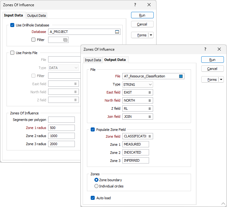
The string file generated by this process can be displayed in Vizex (colour coding the polygons based on classification).