Coordinate Transform
Modern geospatial data are defined in numerous coordinate systems from around the world, which can complicate the process of combining them into a single view. A typical example involves converting government data (in latitude/longitude coordinates) to the working coordinate system of your project; another is converting historic data on an old geodetic datum to a modern geocentric datum.
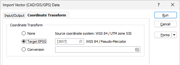
None
If you do not want to convert between coordinate systems as you import your spatial data, select None.
There are currently two conversion options:
Target EPSG
This option is only enabled if the Input file contains recognisable information about the coordinate system that it was registered in. The EPSG number and name of the source coordinate system are provided if they are recognised.
If the Target EPSG option is selected, then the
Conversion
Select the Conversion option to select or create a new coordinate conversion form set to convert between coordinate systems. See: Coordinate System Conversion