Observations
![]()
Once you have setup the parameters for any particular instrument, it is easy to operate, but the initial setup can be complicated because most data recorders are themselves configurable and different types of records are used.
For example, one type may hold data such as a station ID and other reference information. Another type will contain data relating to a specific observation. How these are arranged varies with the type of instrument, and in most cases can be configured by the user. For more information, refer to the Calculating Coordinates of Unknown Points topic.
Import method
Choose whether to import observations directly from the recorder, or from an ASCII file downloaded from the recorder.
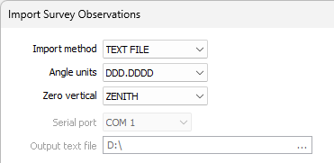
Angle Units
Select the unit of measure for the angle units.
Zero vertical
Choose the zero vertical parameter. ZENITH means that 90 or 270 is horizontal; <90 or >270 is an elevation and >90 or <270 is a depression. HORIZONTAL means that 0 is horizontal, positive values are elevations and negative values are depressions.
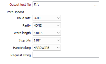
Serial port and output text file
If you have chosen the SERIAL PORT import method, select a port number, specify an output ASCII file name, and specify Connect the Survey Instrument.
Input text file
If you have chosen the TEXT FILE import method, specify an input ASCII file name.
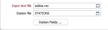
Stations
Enter the Station file name and click Station Fields to enter the field names.
Code Definitions
(Optional) Enter the Code Definition information. There may be one, two or three of these, depending on the instrument.
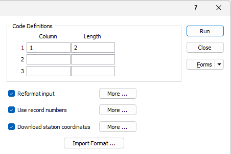
Reformat input
(Optional) Select Reformat the Input and click More to enter the information.
Use record number
(Optional) Select Use selected records and click More to enter the information required if you are not using all records in the file.
Download station coords
(Optional) Select Download Station Coordinates and click More to enter the information. This is only needed if the instrument contains a file holding fixed point coordinates, and this is not the station file.
Import Format
Click the Defining the Input Output Format button to define the input format and field names.
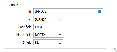
Output
Specify an output filename and the coordinate fields in that file. If the input file contains sufficient data, and Northing, Easting and Z fields are specified, the program will calculate these values and insert them into the output file.
Forms
Click the Forms button to select and open a saved form set, or if a form set has been loaded, save the current form set.
Run
Finally, click the Run button to run the function and generate the output file. A confirmation message will be displayed once the import is complete.