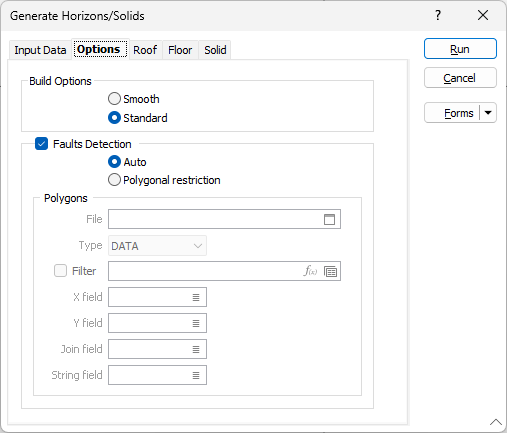
Options
On the Options tab of the Generate Horizons/Solids form, you can set Build and Fault Detection options. Fault detection can either be automatic, or it can honour the polygonal fault zones defined by a file (probably the same file used in the Grid Create process).
You can choose between the following Build options:
| Smooth | When Smooth mode is selected, interpolation is performed in order to smooth the transition between the block edges. |
| Standard | In Standard mode, a triangulation is built using the block outlines and no interpolation is performed. The generated surfaces are coarser as a result. |
Faults Detection
Fault detection can either be automatic, or it can honour the polygonal fault zones defined by a file (probably the same file used in the Grid Create process).
File
To define which polygons will be used, double-click (F3) to select the name of a String file. If necessary, apply a Filter to limit the records to a particular subset of data.
X, Y fields
Double-click (F3) to specify the names of the fields in which the Easting and Northing coordinates are stored.
String field
(Optional) Double-click (F3) to specify the name of the field containing values which define whether data points will be joined by a line. The values of this field in successive records must be the same before the points will be strung.
Join field
Double-click (F3) to specify the name of the field containing values which define whether data points will be joined by a line i.e. strung. If successive records have the same value in this field and no String field is defined, a line will join the points. If a String field is defined, then values in each field in successive records must be the same before the points will be strung.
Use the (Roof, Floor, Solid) Output tabs to define the outputs you require.
