Range Mappings
On the Range Mappings tab, below the Settings in the Block Model Interrogation dialog, specify the block model files that will be used for the interrogation. The data in each file is mapped to a specified range.
Active
Range Maps marked as Active will be included in the calculation. Otherwise, they will be excluded from the calculation.
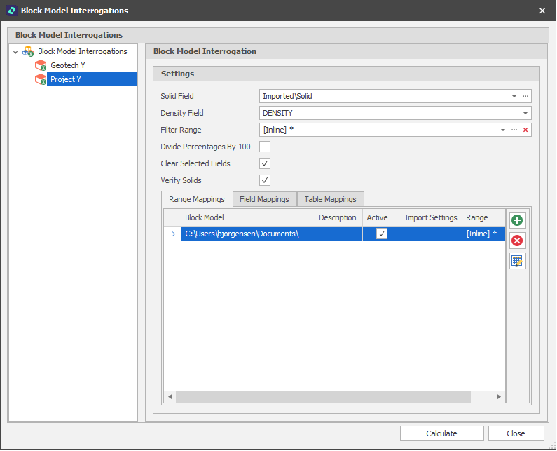
Import Settings
Click on the Import Settings ellipsis to choose how the data in the specified file will be imported. In this example, a Micromine Origin & Beyond Block Model file is being used for the interrogation:
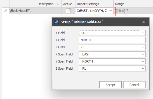
Micromine Origin & Beyond Block Model files are a special flavour of a Data File and have a .DAT extension. Block Model files have no dedicated coordinate fields. Coordinate fields are nominated by the user. Nominated coordinate fields contain block centroid coordinates. Fields prefixed with the underscore ("_") characters contain block sizes.
Range
The Picked or Text Range applied to each Range Map can be edited if necessary:
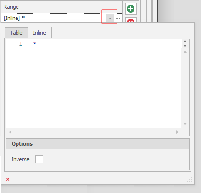
Inverse ranges allow you to set a range that includes everything BUT what is picked. Useful for selective exclusion.