Manual Unfold
The unfolding (and stretching) of folded orebodies is an important requirement for many clients who want to model folded sedimentary deposits. For more information, refer to the Overview topic.
![]()
To unfold an orebody based upon a trend surface, see Unfold (via Trend Model)
For a description of flattening without stretching, refer to the Flatten topic.
Files
The following parameters must be specified on the Files tab of the Unfolding form:
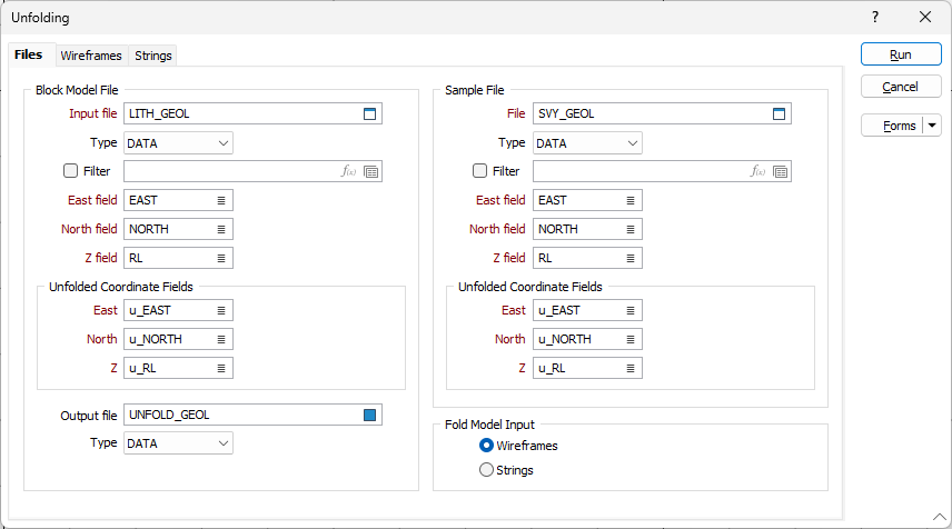
Block Model File and Sample Files
Double-click to select the name of the block model file that will be unfolded, and the name of the Sample file that will be used as the basis for unfolding.
For each file, specify the names of the fields in which the Easting, Northing, and Z coordinates are stored.
Unfolded Coordinate fields
Specify the fields in the input files that will be used to store the unfolded (true geological) coordinates.
File Input Mode
In order to calculate unfolded coordinates, structural interpretations of the folded strata must be provided as either wireframes or as string files. In most cases, these will be hangingwall and footwall structures.
Specify an input type.
Forms
Click the Forms button to select and open a saved form set, or if a form set has been loaded, save the current form set.
Run
When you have set unfolding options and specified a Wireframes or Strings input mode, click Run to begin the Flattening process.