Overview
The unfolding (and stretching) of folded orebodies is an important requirement for many clients who want to model folded sedimentary deposits.
![]()
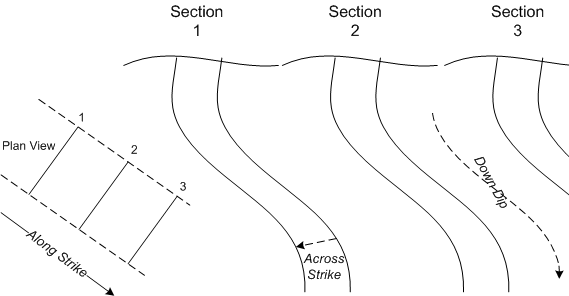
An unfolded coordinate system (UCS) has three axes:
- Across strike
Strike is the direction, or bearing from true north, of a vein or rock formation measure on a horizontal surface. Across strike is in a direction perpendicular to the strike.
- Down-dip
Dip is the angle at which a vein, structure or rock bed is inclined from the horizontal. Down Dip is so called because it is always measured downwards at right angles to the strike.
- Along strike
Strike is the direction, or bearing from true north, of a vein or rock formation measure on a horizontal surface. Along strike is any point along that bearing.
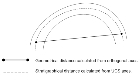
Once the stratigraphical distances between points (rather than the geometrical distance) have been calculated they can be used as inputs when modelling directional variograms for Kriging. Unfolded Kriged estimates can then be applied to the blocks in the folded block model.
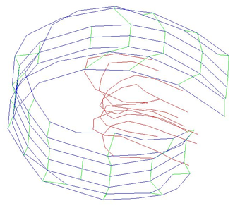
In order to calculate unfolded coordinates, structural interpretations of the folded strata must be provided as either wireframes or as string files. In most cases, these will be hanging-wall and footwall structures.
The inner links and the links between sections need to be defined: