Polygonal Restriction
Polygons can be used to restrict the data that is used as input to various functions. To define which polygons will be used, select the String File or the Outline File input option on the Polygonal Restriction tab.
Keep interior contours
If the Keep interior contours option is selected, the process will keep the contours that lie within the polygons or the outlines in the Restriction file.
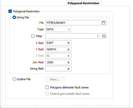
String File
Select a file Type and then double-click (F3) to select the input File that contains the polygons you want to use to restrict the data. Optionally, apply a Filter to limit the records to a particular subset of data.
X, Y fields
Double-click (F3) to specify the names of the fields in which Easting and Northing coordinates are stored.
Z field
(Optional) Double-click (F3) to specify the names of the fields in which Z elevation coordinates are stored.
Join field
In forms that require polylines as an input, the values in this field define whether the data points in the input file should be joined by a line. If successive records have the same value in this field, a line will join the points. If two-factor topology is required, the values in a String field may also be used to segment the lines.
String field
In most forms, the String field is an optional generic attribute used to store a secondary input such as a code. Traditionally, this field has also been used with the Join field to define whether data points should be joined by a line, or strung, hence the name.
Outline File
Select this option and click the More button to select an Outline file containing the outlines you want to use to restrict the data.