Downhole
![]()
The same option is available on the Grade Copilot tab, in the Generate group.
Drillhole Database
Double-click (or click on the Select icon) to select from a list of drillhole databases in the current project.
Press F5 to create a new drillhole database. Press F4 to edit a drillhole database you have selected.
Select the Filter check box if you want to apply a filter to the database. Enter a filter number in the adjacent response. Double click (F3) to see a list of existing filters. Right click (F4) to open the dialog box where you can create a new filter.
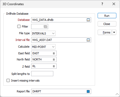
File type
Double-click to select the type of file you want to generate coordinates for (You can specify a file containing INTERVALS, or a file containing EVENTS).
- An Interval file contains information such as lithological or assay intervals collected downhole. Each record in an Interval file contains information about a sampled interval. The location of each interval is defined by a From and a To value. These represent the distance from the hole collar to the start and end of the interval.
- An Event file contains information about events of interest that have occurred at points downhole. For example, an event might be the point along a drillhole where oxidation stops. Note that unlike Assay files, Event files do not have From/To intervals. The depth at which an event occurs is recorded in a Depth field.
Interval file / Event file
Double-click or click on the Select icon to navigate to the location of a file (of the file type you have chosen).
Calculate
If you are generating coordinates for an Interval file, select an option to calculate the ROOF, FLOOR, or MID-POINT of each sample and write those values to the North, East and Z fields in the file.
East and North and Z fields
Specify the names of the fields in which Easting, Northing, and Z coordinates will be stored in the output file. If no fields are specified, the Auto default will apply and the fields will be created automatically. Any fields already existing will be overwritten but will retain Type, Width and precision values.
Split lengths to
If you are generating coordinates for an Interval file, (optionally) use the Split lengths input to split long sample intervals into smaller intervals. Enter a value in metres. When an entry is made, unsampled intervals of the defined length, and with a suitable 'From' and 'To' depth, will be inserted into the file. Divide sample intervals in the Interval file
Insert missing intervals
If you are generating coordinates for an Interval file, (optionally) select the Insert Missing Intervals option to insert records for those downhole intervals not already in the Interval file.
Report file
To help locate errors in the Drillhole Database, you have the option to generate a Report file. To do this, enter a name in the Report file prompt. Errors and inconsistencies located in the Collar, Survey or Interval files will be recorded in this file. Right-click (F4) to open the file after running the process.
Running the process will create fields automatically if not previously present, and overwrite already existing fields. If the required fields are blank/ Auto, the Easting, Northing and RL values from the collar file will be utilised.
Forms
Click the Forms button to select and open a saved form set, or if a form set has been loaded, save the current form set.
Run
Click Run and a series of status messages will appear as Downhole Coordinates processes the drillhole files. If an error is detected a message describing the error will be shown. Otherwise the coordinate file will be created.