Export to IREDES
![]()
When exporting to an Epiroc formatted IREDES file, you can select an option to write navigation holes to the output XML file. Navigation holes are used for the positioning of the drill rig and for the conversion of the coordinates to those of the Rig Control System.
International Rock Excavation Data Exchange Standard (IREDES) is an industry standard to unify routines for the data exchange between mining equipment and office computer systems. The input/output file type is XML.
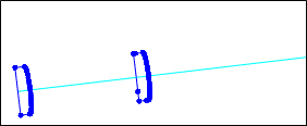
A Heading Design layer must be open in Vizex and be the active layer. You will be prompted to select the tunnels or rounds you want to export:
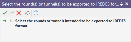
If you select a tunnel, all the rounds on that tunnel will be included in the export. You can also use the mouse to select multiple tunnels and rounds. To exclude or add individual rounds, use the mouse with the CTRL key to refine your selection.
Heading Database
When you have selected a tunnel and the rounds to export, the Export Heading Design form is displayed.
The Heading Database and the tunnel and round you have selected in the display are shown in the Heading Database group and are display only. You cannot change the selection unless you close the form and reselect them interactively.

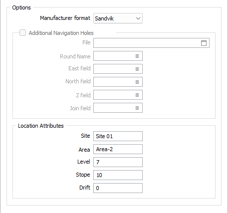
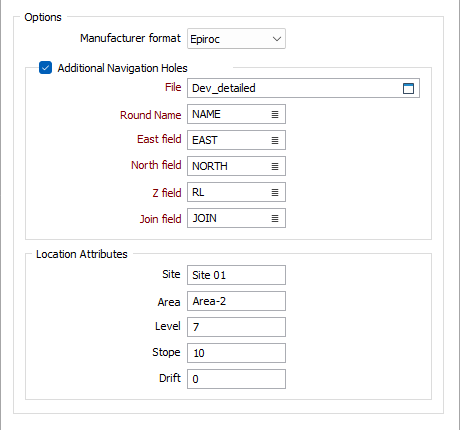
Options
Manufacturer format
The format of the export to IREDES differs based on manufacturer. The following formats are currently supported:
Option: Sandvik
When Sandvik is chosen as the manufacturer format the Location Attributes can be set.
You can specify the Site, Area, Level, Stope, and Drift location attributes.
Option: Epiroc
When Epiroc is chosen as the manufacturer format, the Additional Navigation Holes options are enabled.
File
If you select the Additional Navigation Holes check box, you must specify a file containing the location of navigations holes. When this file is specified, the coordinates of the navigation holes are written to the output XML file.
Ring Name field
Enter (or double-click to select) the Ring Name field to set the field for the ring name from the selected string file.
East field
Enter (or double-click to select) the East field for the export.
North field
Enter (or double-click to select) the North field to specify the field for North.
Z field
Enter (or double-click to select) the Z field to set the field where Z values are stored in the export file.
Join field
Enter (or double-click to select) the Join field for the export file.

Location Attributes
In the Location Attributes section of the Export Heading Design to IREDES form, you can specify various location attributes, such as Site, Stope and Drift.
Site
Enter the name of the Site for the export file in the Site field.
Area
Enter the Area local attribute in the Area field.
Level
Enter a level for the local attributes, if applicable, in the Level field.
Stope
Use the Stope field to enter the stope local attribute.
Drift
Enter the drift local attribute in the Drift field.
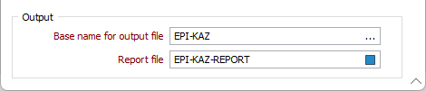
Output
Base name for output file
A separate output file will be generated for each round on each tunnel. A suffix is added to the base name to make each name unique.
Report file
Specify a name of a report file which reports the results of the export. The name of each round and the number of drillhole that have been exported are included in the report.