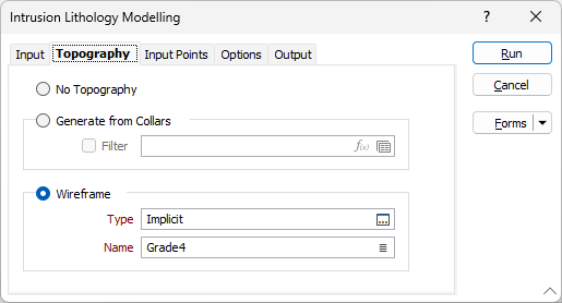
Topography
On the Topography tab of the Intrusion Lithology Modelling form, configure the method to be used to generate topography for the intrusion model; from collars or wireframes.
No Topography
Use the No Topography option if you do not want to generate topography for the model and simply fill the defined extents.
Generate from Collars
Select the Generate from Collars option to generate topography from the collar data in the drillhole database.
You can select the Filter check box and select a filter to determine the records in the drillhole database that will be processed for collar information, if required.
Wireframe
Select the Wireframe option to choose a wireframe surface that represents the topography. Select the Type of the wireframe and the Name of a wireframe of that type.
If the selected topography does not cover the extents of the modelled region, a warning prompt will be displayed.
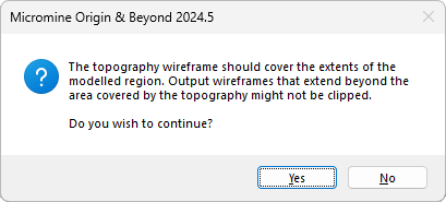
Click Yes to continue or No to cancel the modelling process.