Google KML
![]()
Keyhole Markup Language (KML) is an XML-based language for managing the display of 3D geospatial data. For its reference system, KML uses 3D geographic coordinates: longitude, latitude and altitude. The longitude and latitude components are as defined by the World Geodetic System of 1984 (WGS 84).
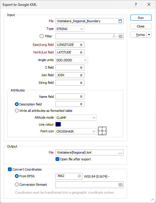
Input File
Select a file type and then enter (or double-click to select) the name of the file containing the data to be exported. If required, define a filter to selectively control which records will be included in the export process.
When you export to Google Earth KML format, Point, Polygon or Path (Polyline) placemarks are written to the output file. String and/or Join values must be specified in order to export polyline or polygon placemarks. If no String or Join values exist, point data is assumed.
East/Long and North/Lat fields
Double-click to select the fields that contain either Eastings and Northings or WGS 84 Longitudes and Latitudes.
The output coordinate system must be WGS 84 Geographic (Latitude/Longitude). If the input data is on a different coordinate system, use the Convert Coordinates option on this form (see below) to convert the data to WGS 84 geographic during the export process
Angle Units
Select the Angle units in which the latitudinal and longitudinal values are (or will be) expressed.
- DDD.DDDD is degrees and decimals of a degree. This is the recommended format. A longitude value of 123° 7' 54.648'' is written as 123.1318467.
- DDDMM.MMM is degrees, minutes and decimals of a minute. Many GPS receivers output data in this format. A longitude value of 123° 7' 54.648'' is written as 12317.9108.
- DDD.MMSS is degrees minutes and seconds. This format is favoured by surveyors and mapmakers, but because it is almost indistinguishable from decimal degrees it is not recommended for locational data. A longitude value of 123° 7' 54.648'' is written as 123.0754648.
Z field
If Altitude mode is not 'Clamped to ground' (see below), the values in the field you nominate will be used to obtain altitude values.
Altitude values are not the same as Z values.
Join field
In forms that require polylines as an input, the values in this field define whether the data points in the input file should be joined by a line. If successive records have the same value in this field, a line will join the points. If two-factor topology is required, the values in a String field may also be used to segment the lines.
String field
In most forms, the String field is an optional generic attribute used to store a secondary input such as a code. Traditionally, this field has also been used with the Join field to define whether data points should be joined by a line, or strung, hence the name.
Attributes
Name and Description
Double-click to select the input fields that will be written to the Name and Description attributes of the KML output file.
Write all attributes as formatted table
As an alternative to mapping the Description attribute of the KML output file to a single field in the input file, select this option to write ALL of the field values of the input file to the Description attribute (in tabular HTML format).
Altitude mode
Altitude mode can be CLAMPED TO GROUND, RELATIVE TO GROUND, or ABSOLUTE HEIGHT. Clamped to ground is the default and should be used for anything other than a flight. If Clamped to ground is selected, the altitude is set to zero.
If Relative to Ground or Absolute Height are chosen, the points will be given the altitude obtained from the field specified as the Z field in the input file.
Line colour
Double-click on the Colour icon to set a colour for exported path or polygon placemarks.
Point icon
Select the icon that will be used to represent the placemarks in the Google Earth display. Select an icon from the list of (PUSHPIN, TARGET, PLACEMARK SQUARE, PLACEMARK CIRCLE) Google Earth icons. A preview of the icon is shown when you select it.
Output
Enter (or double-click to select) the name of the output file. If you are entering the name of the file, the specification of a (.kml) file extension is optional.
Google Earth is primarily a consumer visualisation tool and is not a rigorous GIS application. Google Earth images may therefore have shifts of a few metres, or even a few dozen metres, when compared with GIS data from other sources.
Convert Coordinates
To convert between coordinate systems, select the Convert Coordinates check box and choose one of the following options. The coordinates must be transformed into a geographic coordinate system.
From EPSG
Select this option to Search for a coordinate system by name or enter the EPSG (European Petroleum Survey Group) code if you already know it. For example, the geographic WGS 84 coordinate system has the EPSG code 4326.
Conversion
Select, or create a new, coordinate conversion form set. See: Coordinate System Conversion