Bowditch
![]()
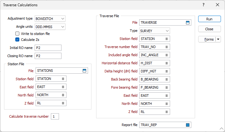
You need an input (control) file containing the traverse information, as generated by the Mean Observations function. This can contain one or more traverses, and the Traverse function allows you to adjust one at a time. You also need a Station file containing details of the known starting and closing points.
You can choose to write the adjustments back to the control file.
To adjust Traverse observations:
- On the Survey tab, in the Traverse group, click Bowditch.
- (Optional) Select the Calculate Z values check box to calculate reduced levels.
- Choose the adjustment type. Bowditch is the usual choice unless angular measurement is more accurate than distance measurement.
- Choose an option from the Angle units list box.
- Enter the name of the Station file and the field name information.
- Select the Write to Station file? check box if you want to write adjusted station coordinates to the Station file.
- Enter the number of the traverse you want to adjust.
- (Optional) enter the initial and closing RO names.
- (Optional) Enter a name for the report file. A record of adjustments will be written to the file.
- Choose the traverse file type and select or enter its name and field names.
- Run the function.
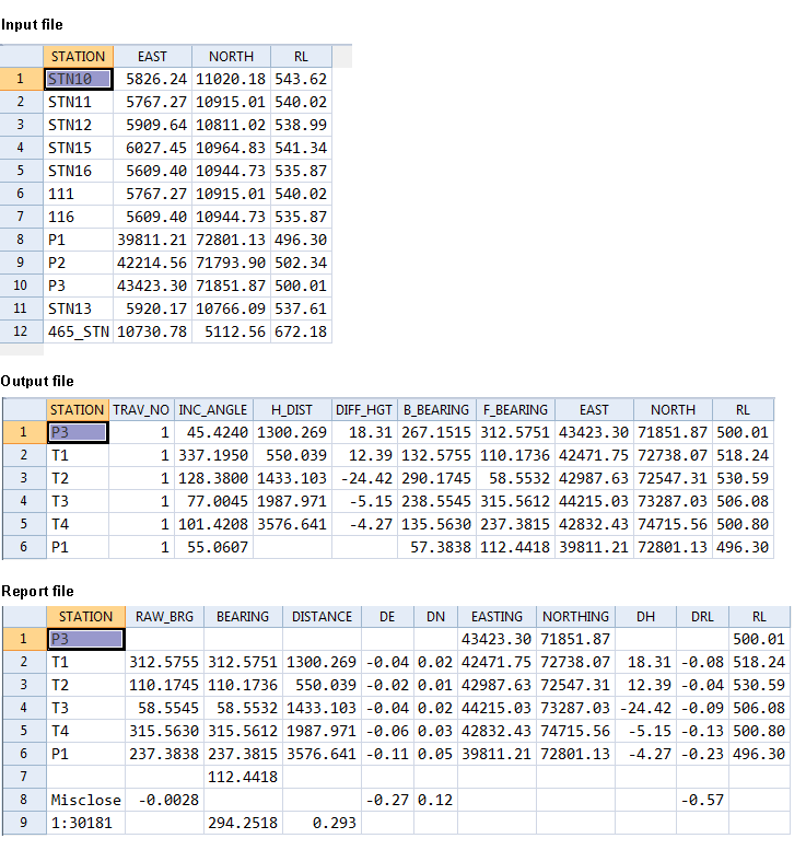
- A dialog box now shows the bearing misclose. If this is acceptable, click Yes to continue.
- A dialog box shows the misclose in coordinates, Z, bearing and distance. You can click Yes to carry out the adjustment.
- The function now calculates the adjustments and writes the new stations and their coordinates to the Control file (if that box was checked).
Reference Bearings
If the coordinates of the initial and closing ROs are not in the Station file and/or you did not enter their names in the dialog box, the program will prompt you for initial and closing reference bearings.
Current Coordinates
If the station in the first record is not found in the Control file, you will be asked if you want to use the current coordinates. Key 'N' to abort the function so you can add the information to the file, or 'Y' to use the Northing, Easting and Z values found in the first record. If there are no values, 0.0 will be used for each.
No Closing Station
If the closing station is not found in the Control file, a message will tell you that the traverse will be calculated as Open (no adjustments). However, there will still be a full printout and coordinates will be added to the Control file.