Vertical
![]()
Angle units
Select the Angle Units that will be used for latitude and longitude values.
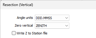
Zero vertical
Choose the zero vertical parameter:
- ZENITH means that 90 or 270 is horizontal; <90 or >270 is an elevation and >90 or <270 is a depression. HORIZONTAL means that 0 is horizontal, positive values are elevations and negative values are depressions.
Write Z to Station file
If this check box is selected the Z calculated by this function will be written to the Station file.
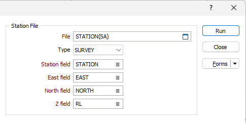
Station file
The file containing the coordinates of the occupied (resected) and observed stations.
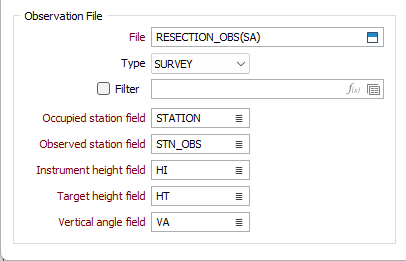
Observation file
The file containing the observed vertical angles from the unknown point to the known points.
Report file
Enter or double-click (F3) to select the name of a Report file. If the Report file already exists, you will be prompted to Overwrite or Append.
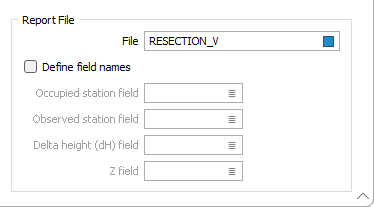
There are two options when specifying report output fields:
- Use the default fields
Occupied | Observed station - same field specification (type, width decimals) as in the Input file.
Delta height - Name = "dH", Numeric, 8, 3 (Z - same field specification (type, width decimals) as in the Station file.)
- Define field names Enter the field names (compulsory) to be used in the Report file.
If a field name already exists in the Report file, the existing field specification (type, width and decimals) will be used. Otherwise the default field specification will be used.