Assign
![]()
Each point in the data file is projected onto the grid. The Z value of the data point is compared to the Z value of the grid. The value written to the Code field for that point depends on whether the point is above, below or outside the grid.
Grid file
On the Grid Assign form, double-click to select the name of the Grid file you created in the Contours function.
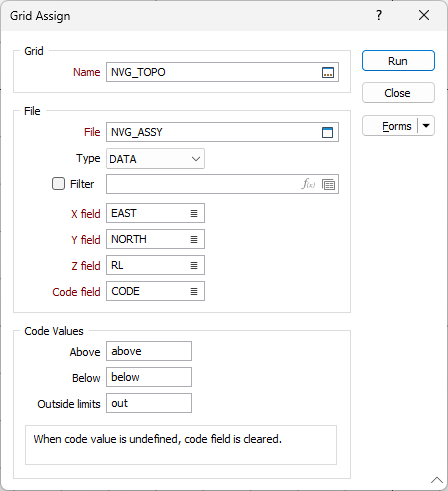
MM file
Enter the name of the input file and apply a filter if necessary.
East and North and Z fields
Specify the names of the fields in which Easting, Northing, and Z coordinates will be stored in the output file.
Code field
Double-click to select the Code field name. Values indicating whether a point is above, below or outside the Grid will be written to this field.
Code values
Enter the values you want written to the code field for each of the possible assignments. A value will be written to the code field when the point is Above or Below the triangulated surface, or Outside the area covered by the triangulated surface.
Run
Finally, click the Run button to run the function.