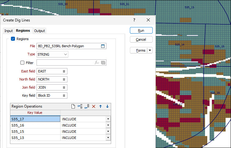
Regions
On the Regions tab of the Create Dig Lines form, enable the Regions check box to specify zones to within which the dig lines should be confined, or from which they should be excluded. Regions can be delineated with polygons in a String file or Data file.
File
Select a file type and then double-click, or click on the Select icon, to select the file containing the polygons that define each region.
East and North and Z fields
Specify the names of the fields in which Easting, Northing, and Z coordinates are stored in the file.
Join field
The values in this field define whether the data points in the input file should be joined by a line. If successive records have the same value in this field, a line will join the points and will be closed to delineate a region.
Key Value
Specify the value in the Key field for the polygon that delineates the zone.
Operation
Specify the zones within which the dig lines will be INCLUDED or EXCLUDED.