Surface Points
![]()
In most cases you will need to carry out some trial and error processing to determine the optimum settings for the parameters in the Grid Definition tab of the Surface Points form.
Use caution with this function. It is intended for sparse data and should only be used with a small number of input points (< 5000). Including too many points may overwhelm the PC whilst producing a poorer result than would be achieved using fewer points.
Input
On the Input tab of the Surface Points form, specify the name of an Input file and the names of the required fields in the file.
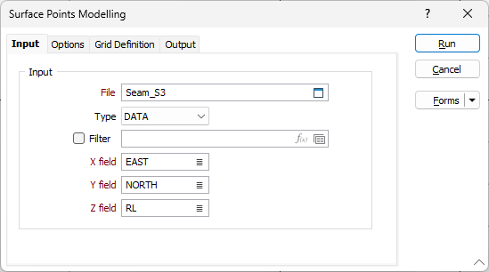
File
Select a file Type from the drop down and double-click (or click on the Select icon) to select the name of the file containing your data.
Filter
Select the check box and set a filter from the field if you want to filter the information in the selected input file.
Grid/Interpolated field
Double-click to select the name of the field containing the values that will be used for the calculations.
X and Y fields
Double-click to select the name of the fields containing X and Y coordinates.
Forms
Click the Forms button to select and open a saved form set, or if a form set has been loaded, save the current form set.