Attributed Points
![]()
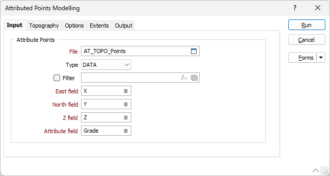
File
In the Attributed Points Modelling form, double-click (or click on the Select icon) to select a File containing the point attributes you want to model.
Typically, you will get the point file by running a function on the Implicit | Lithology function and then generating an interpolated points output file. This file may then be edited to extend the geology in a specific direction, or join two separate lithology units.
East, North and Z fields
Double-click to select the names of the coordinate fields in the Input file.
Attribute field
Double-click to select the names of the field that contains the values to be modelled.
The field will have negative and positive values - if you set the cut off to zero in the Output tab, negative values will be excluded from the wireframe, positive values will be included, and zero will be the points that the wireframe passes through.
Forms
Click the Forms button to select and open a saved form set, or if a form set has been loaded, save the current form set.
Note: To better utilise processor resources across multiple applications and tasks, when running computer-intensive operations it may be necessary to reduce the number of cores used by the application.
To modify the number of cores the application can use:
-
Click the Project tab to open the backstage menu.
- Click on the Resources tab of the Options | System | System Options form.