Spatial Database Settings
You can import data from a Microsoft SQL Server (Microsoft SQL Server 2008 and later) or PostgreSQL spatial database by entering the parameters needed to build a valid connection string.
"MSSQL:server=<server_name>\<server_name>;database=<Database>;tables=<schema>.<table>(<column name>);trusted_connection=yes"
"PostgreSQL:database=<Database>;host=<Host>;port=<Port>;tables=<schema>.<table>(<column name>);trusted_connection=yes"
Server
Specify the name of the server where the database you are connecting to is stored.
Database
Specify the name of a database located on the server.
Host
For PostgreSQL, enter the name of the host for the database. This must be a resolvable host name such as would be used to open a TCP/IP connection or ping the host. If the database is on the same computer as the GIS system, simply enter localhost.
Port
Enter the port number that the PostgreSQL database server listens on. The default port for PostGIS is 5432:
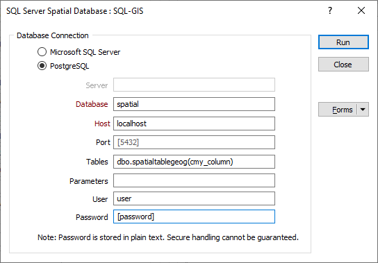
Tables
If the table field is left blank, all spatial tables in the database are included.
If a table and a schema name are specified, then a column name must also be specified.
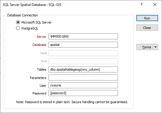
Parameters
Extra parameters may be specified in addition to the standard parameters of the connection string. A working knowledge of SQL Server connection strings is assumed.
For more information, refer to:
User
Where access to the database requires user credentials, enter the User name.
Password
Enter the Password for the User to access the specified database.