Road Design
![]()
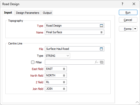
Topography
Type
On the Input tab of the Road Design form, double-click (or click on the Select icon) to select one of the wireframe types in the current project. A wireframe type is a name used to categorise a wireframe. All wireframes, no matter what their type, are the same - collections of triangles, attributes and metadata.
Name
Double-click (or click on the List icon) to select the name of the topographic surface you want to use as input to the process. You can also use the Pick from Vizex button (or select the context menu option where available) to collapse the form and interactively select the required Wireframe to insert and return to the form.
Centre Line
File
Double-click (F3) to select the name of the source file containing your string data. If required, define a filter to selectively control the records to be processed.
Easting, Northing, Z fields
Specify the names of the X, Y and Z coordinate fields in the file.
Join field
Specify the name of the field containing values which define whether data points will be joined by a line i.e. strung. If successive records have the same value in this field, a line will join the points.
Forms
Click the Forms button to select and open a saved form set, or if a form set has been loaded, save the current form set.
Run
When you have set profile parameters and specified output options, click Run to generate the road.