Scaling
When a Plan View is configured (and the sections for viewing in the plan view have been configured), default horizontal and vertical scaling options can be set on the Configuration | Scaling tab of the Section Property Editor.
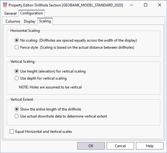
Horizontal Scaling
- No scaling (i.e. Proportional). The drillholes are equally spaced across the width of the display.
- Fence style The scaling is based on the actual distance between drillholes.
Vertical Scaling
By default, height values will be retrieved from the HEIGHT_FROM and HEIGHT_TO columns in the downhole result set. These values should represent the height (above datum) corresponding to the DEPTH_FROM and DEPTH_TO values respectively. If the height columns are not included in the result set, then height values are calculated from the depths below collar, based on the assumption that the drillhole is vertical.
Vertical Extent
Show entire length of the drillhole is the default option.
The Use actual downhole data to determine vertical extent option allows you to override this behaviour by instructing Micromine Geobank to use the downhole data to determine the vertical extent. See: Option to determine the vertical extent from downhole data
Equal Horizontal and Vertical Scales
Select this option to fix the Horizontal scale relative to the Vertical scale. This allows the true dip of seams and horizons to be seen.