Option to determine the vertical extent from downhole data
By default, the vertical extent for a correlation diagram is determined by examining the collar and end-of-hole elevations of the drillholes included in the section.
The Use actual downhole data to determine vertical extent option allows you to override this behaviour by instructing Micromine Geobank to use the downhole data to determine the vertical extent. The section will therefore include only a predefined vertical subset of the drillhole data. For example, you could choose to view a section showing only a given seam, including a predefined margin above and below the seam.
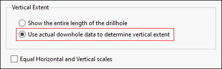
When this option is combined with a downhole query that retrieves a vertical subset of the data, the section will automatically "zoom in" on this subset.
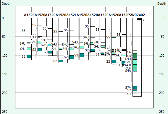
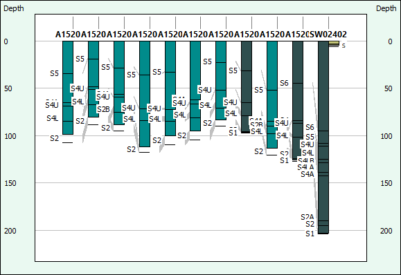
The following examples show a section with the option disabled and enabled respectively.
With the option disabled (default setting), the collar elevations and end-of-hole depths of the drillholes are used to determine the vertical extent of the section.
With the option enabled, the vertical extents are adjusted to include only the zone represented in the downhole data (in this case, a zone extending at least 3m above and below the number 4 seam).
It is possible to construct a similar drawing by creating a “false” collar elevation and end depth. However, this will only work when the section is opened from the Micromine Geobank object tree. When the section is opened from the plan view, Micromine Geobank overrides the collar dataset, returning the original collar elevation and end-of-hole depth from the collar survey view.