Edit Waypoints
To edit a waypoint in Reference Edit:
- Double-click on the new waypoint to open the Properties window.
- In the General tab, enter a Description and an Abbreviation for the waypoint.
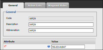
- Review the attributes of the waypoint and edit where applicable. Required attributes are denoted with an asterisk*:
| Attribute | Description |
|---|---|
| X | * Easting coordinate. |
| Y | * Northing coordinate. |
| Z | * 0 (elevation or RL coordinate) |
| XY Radius | * 10.000 |
| The radius of influence about the point. | |
| Z Threshold | * 0.000 |
| The measurement either side of the point in the Z dimension. This further defines the zone of influence of the point. | |
| MstID | 0 |
| The MST tag number associated with the point. | |
| WaypointDeviceId | The identification number of a device or tag reader located at the waypoint. |
| This attribute must be defined if a tag reader is associated with the location. Tag readers monitor any tagged equipment or personnel that pass the waypoint if a tagging system is used on site. | |
| MineLevel | Select one of the defined mine levels. |
| Mine levels are defined in the Groups | Configuration Items | Locations | Mine Level reference group. | |
| IsSurface | Boolean, defined as: |
|
- Finally, click Apply to save your changes.
To define the actions associated with a waypoint, click on Waypoint Rules tab. See: Defining a Waypoint Rule