Location States
Location States are displayed in a Location Status Panel.
When you create a Location Status panel, a data grid containing the locations, attributes, equipment and states you have specified is displayed.
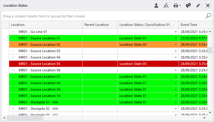
Each row in the data grid represents a location. The attributes and equipment assigned to a location are displayed as columns.
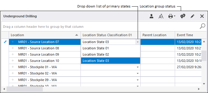
While the attributes of a location and the equipment assigned to it are displayed for information only, the primary and secondary states of a location can be changed by selecting an option from a drop-down list.
- Primary states. Tell you what is happening at a location. For example, Bogging, Charging and Cleanup describe the activity at the location: To Fire, To Charge and To Bog let you know that the location is waiting for the next activity.
- Secondary states. These states generally tell you something more about a location. For example, they could describe the quality of communication at a location - Good Coms, No Coms or Weak Coms.
To change the primary or secondary status of a location:
- Select a Location row and then select a Status column.
- Change the status by selecting an option from the drop-down list provided:
When you create or modify the panel, you can choose to colour-code the rows of the grid:
- Time violation. If a location has been in the current state for a period longer than a defined status duration, the row for the location is coloured according to a set of defined thresholds. Thresholds are defined via Tools | Delays Display Options in Data Acquisition.
- Status colour. The rows in the grid can be colour-coded by current status. The colours associated with each status are defined in Reference Edit.