Distance Calibration
The following outlines the calibration procedure for distance calculation with your configured bluetooth tags and waypoints.
Distance is calculated by RangingData, FarPointRSSI and FarPointDistance, to make sure mobile gets more accurate distance estimation.
Note: If mobile phone devices are in close proximity to Bluetooth beacon or Trek/Motium devices, they can cause interference, which will lead to inaccurate calibration values.
Before performing the calibration procedure, please set up one location tag in Reference Data - see Bluetooth Tag Configuration.
Then select a device (Trek or Motium) as the standard device to start the calibration procedure:
-
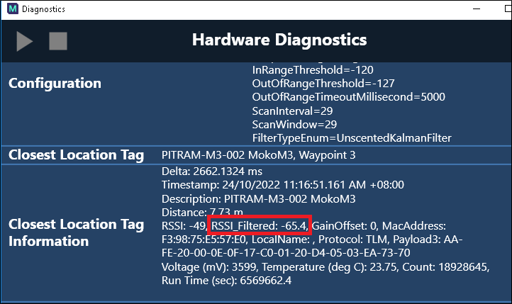
Place the beacon at 1m and note down the value of FilteredRSSI. Enter this value into Dome as RangingData.
FilteredRSSI can be found by pressing F5 → Hardware Diagnostics → BluetoothProfile.
Note: The distance shown is not accurate at this stage.
The FilteredRSSI value can vary, please note down the most frequent value that appeared.
-
Place the beacon at 15m (or a similar distance) and note down the value of FilteredRSSI. Enter this value into Dome as FarPointRSSI.
-
Enter 15 (or whatever distance was used in step 2) into Dome as FarPointDistance.
Now the distance calculation should be accurate for this device.
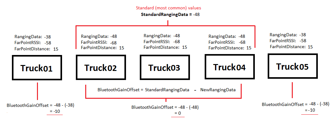
For all other devices, the same calibration procedure needs to be done, if all values are the same or within +-1 difference, BluetoothGainOffset in mobile unit configuration can be set as 0 (default value).
If it’s different, for example, standard device RangingData is -48, FarPointRSSI is -68 at FarPointDistance 15 meters. The other device for Truck 2 is having RaningData -68, FarPointRSSI is -88 at FarPointDistance 15 meters. Then in MobileUnitConfiguration for Truck02, BluetoothGainOffset should be set to -20.