Grid
![]()
Input
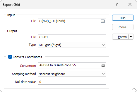
Double-click in the File box (or click on the Select icon) to select the Micromine (.GRD) Grid file you want to export.
Output
Select a file Type and then enter (double-click in the File box or click on the ellipsis to select) the name of the File that will be generated by the process. You can export to any of the following grid and raster file formats:
|
File Format |
Extension |
|---|---|
|
GXF – Grid eXchange File |
gxf |
|
Surpac Minex grid |
grid |
|
Arc/Info ASCII Grid |
asc |
|
ESRI .hdr Labelled |
hdr |
|
ER MAPPER (ERS) |
ers |
|
Erdas Imagine Images |
- |
|
ASCII Gridded XYZ |
- |
|
Intergraph Raster |
- |
|
SAGA GIS Binary Grid |
sdat |
|
Virtual Raster |
vrt |
|
Idrisi Raster A. 1 |
rst |
|
Golden Software ASCII |
grd |
|
Golden Software Binary |
grd |
|
Golden Software Surfer 7 Binary Grid |
grd |
|
Tagged Image File Format |
tif |
Convert Coordinates
Select the Convert Coordinates check box to convert between projected or local coordinates and geographic coordinates (latitudes and longitudes) as part of the export process.
Conversion
Select, or create a new, coordinate conversion form set. See: Coordinate System Conversion
Sampling method
Select a sampling method:
| Method | Input Cells | Calculation | Properties |
|---|---|---|---|
|
Nearest Neighbour |
1 (1 × 1) |
Returns the nearest cell value |
|
|
Bilinear |
4 (2 × 2) |
Combined linear interpolations along the X and Y axes |
|
|
Cubic |
16 (4 × 4) |
Cubic convolution |
|
|
Cubic Spline |
|
Piecewise cubic polynomial |
|
|
Lanczos |
|
Windowed sine cardinal (Sinc) function |
|
Null data value
Specify the value that will be stored when null values are returned during the conversion.