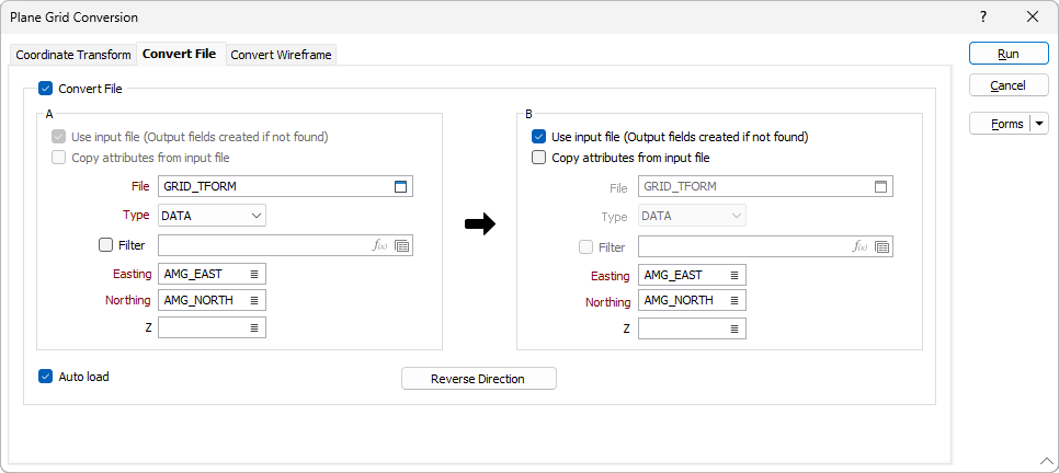
Convert File
On the Convert File tab of the Plane Grid Conversion form, select the Convert File check box to transform all the points in a file and optionally write them to an output file.
Common points must be defined on the Coordinate Transform tab of the form before the Convert File options can be configured.
A
In the A section of the Convert File tab, you can enter the details for the file to be converted.
Use input file
If you use the Reverse Direction function, the Use input file check box is enabled. Selecting the check box will convert from the file you select in the B section and Output fields will be created if not found. By default, the direction is not reversed and this check box is disabled.
Copy attributes from input file
Select the check box to use the attributes from the input file to configure the same attributes for the output.
File
Use the folder selector to set the file to be used for the conversion. This field is disabled if the Reverse Direction function is activated and the Use input file check box is not selected.
Type
Where you have selected a File, select the file type from the drop down.
Filter
Select the Filter check box and set a filter using the selector if you want to filter the information from the selected file.
Easting/Northing/Z
Specify the names of the fields in which Easting, Northing, and (optionally) Z coordinates will be stored in the destination file.

B
In the B section of the Convert File tab, you can configure the details of the destination.
Use input file
Selecting the check box will convert from the file you select in the A section and Output fields will be created if not found. If the check box is not selected, you must specify a file to be used.
File
Where applicable, select the file to be used for the conversion destination.
Type
Set the file type for the selected file from the drop down.
Filter
If you want to filter the information from the selected file, select the Filter check box and set the filter from the field provided.
Easting/Northing/Z
Specify the names of the fields in which Easting, Northing, and (optionally) Z coordinates will be stored in the file. Apply a constant Z shift value for Grid A and Grid B to ensure that all Z values are greater than zero.
Auto load
Select this check box to load the generated output in Vizex.
Reverse Direction
The Reverse Direction function toggles the direction of the conversion from the details in A to those in B, or B to A.