Plan and Section Views
This
Georeferenced Images in Plan View
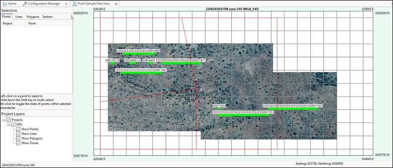
Support has been added for the placement of georeferenced images based on area-in-view as a background in Plan Views. The new functionality renders a scaled and located portion of georeferenced images.
Micromine Geobank will scan the configured Plan View Images folder (see Options) for supported file formats with Easting and Northing georeference coordinates which match the Plan View and display them in the background.
Currently, supported image types are:
-
.tiff , .tif
-
.jp2 , .j2k
-
.jpg , .jpeg
-
.png
Files in the .jpg, .jpeg and .png format require a Micromine Origin format georeferenced metadata file (.grf ) of the same name in order to be matched to the Easting and Northing of the Plan View and be displayed. Files of this type will not be considered georeferenced by Micromine Geobank without a matching .grf file.
Micromine Geobank will use the .grf file of the same name for georeference of .tiff, .tif, .jp2 and .j2k files, if there is one. If no matching .grf file exists, the application will use the metadata stored in the file itself.
In Plan View when Show Background Images is selected, the images to display are chosen by a simple numerical comparison of the area displayed to the area covered by each image. If your projects are in multiple CRS zones, configure a folder per CRS.
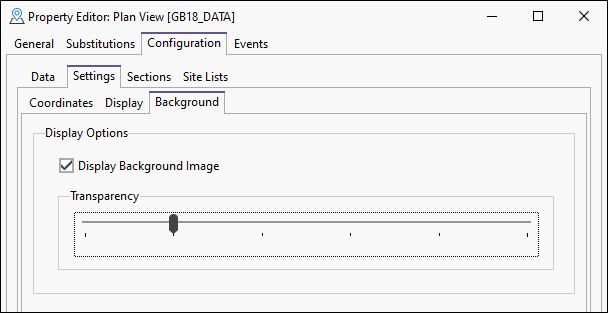
Background Image Configuration
The Background tab has been added to the Configuration | Settings page of the Plan View Property Editor. The options on the tab are used to configure the behaviour of background images for the plan view. These options set the default behaviour in the plan view. They can be modified from within the plan view using the Background Image menu in Tools.
Plan View Intelligent Image Loading Performance
Smart algorithms have been used to optimise the performance of Plan View when a user interacts with the display. To optimise performance, only the images or parts of images 'in view' are retrieved and shown as the user pans. Resolution adjusts with zoom level to show image detail as it is required.
Plan View GDAL Support
Support for the GDAL (gdal.org) geospatial data format has been added to Micromine Geobank. The application makes use of the GDAL format interpretation functionality for georeferenced images in Plan View.
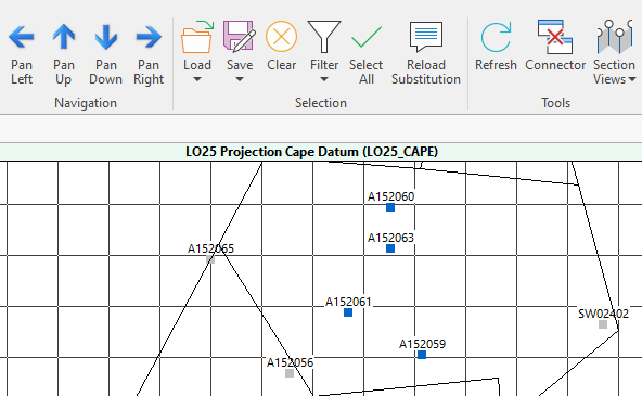
Refresh Button
A Refresh button has been added to Plan View so that the drillholes displayed can easily be updated if the underlying data has changed, such as new rows being logged.
For users in the field viewing a Plan View alongside entering data, the Refresh button retrieves updated data from the database, reflecting it in the Plan View, without the repeated input of the substitution parameters, if any are applied.
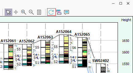
Refresh Button
A Refresh button has been added to Correlation Diagrams so that the drillhole sections displayed can easily be updated if the underlying data has changed, such as new rows being logged.
For users in the field viewing a Correlation Diagram alongside entering data, the Refresh button retrieves updated data from the database, reflecting it in the Correlation Diagram, without the repeated input of the substitution parameters, if any are applied.