Polygon Attributes
The results of the calculation can be written to a Report file or (when the input file is a String file) be assigned to fields in the Input file.
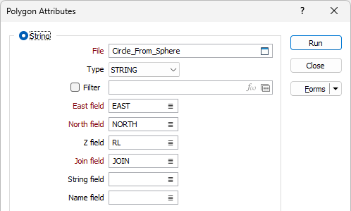
String
File
Double-click (F3) to select the name of the source file containing your string data. If required, define a filter to selectively control the records to be processed.
Easting, Northing, Z fields
Specify the names of the X, Y and Z coordinate fields in the file.
Join field
In forms that require polylines as an input, the values in this field define whether the data points in the input file should be joined by a line. If successive records have the same value in this field, a line will join the points. If two-factor topology is required, the values in a String field may also be used to segment the lines.
String field
In most forms, the String field is an optional generic attribute used to store a secondary input such as a code. Traditionally, this field has also been used with the Join field to define whether data points should be joined by a line, or strung, hence the name.
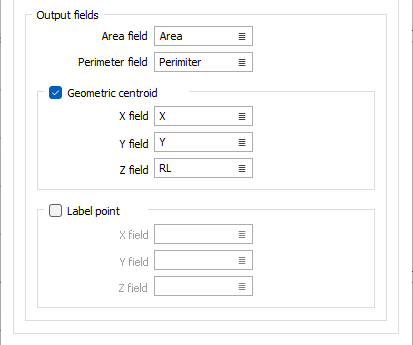
Output fields
Optionally, double-click (F3) to select the names of the fields to which the calculated Area and Perimeter values will be written.
Select the Geometric centroid check box to calculate the geometric centroids of the polygons in the file. Double-click (F3) to select the names of the fields to which the calculated geometric centroid X, Y, Z coordinates will be written.
Select the Label point check box to calculate the geometric centroids of the polygons in the file. Double-click (F3) to select the names of the fields to which the calculated label centroid X, Y, Z coordinates will be written.
Outline
If Outline is chosen as the input option, click the More button to open the Outline Restrictions form.
Output
Report file
Double-click (F3) to select the name of the Report file where the area and perimeter values for each string or outline will be written.
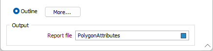
Run
Finally, click the Run button to begin the area calculation process.