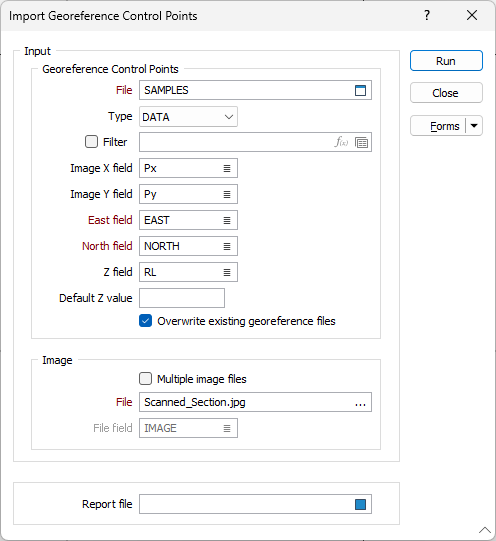
Import Georeference Control Points

There must be at least 3 GCPs per image file. For each filename, the import function will calculate the appropriate dimensions, coordinates, and rotations, and then write them to one GRF file per image.
Input File
In the Import form, specify the name of the file containing the GCPs for one or more image files. To navigate to the location of the file, double-click in the File box (or press F3 with the cursor in the File box).
The Input file must be a data file that contains:
|
Image filename (Optional) |
Image X |
Image Y |
Easting |
Northing |
Z (Optional) |
The specification of an image filename is optional. If no filename is specified then the first ten GCPs are written to a GRF file with the same name as the input data file. If you wish, you can also specify a Default Z value.
Image
If multiple image filenames are specified in the input file, select the Multiple image files check box option. Double-click to select the name of the field that contains the image filenames.
If you are importing GCPs for a single image, double-click in the File box to select the image you want to create a georeference file for.
Report
If errors are encountered (image file names have insufficient GCPs or the output file already exists etc.) then those files will not be processed and the details of each error will be written to the specified report file.