Files & Projects
This
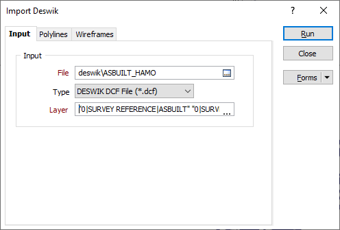
Import Deswik Wireframes and Strings
On the File tab, in the Import group, you can now select an option to import and display data in a variety of Deswik file formats. Polyline features and 3D solids can be imported.
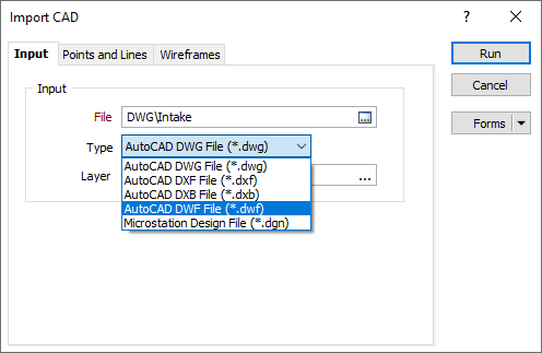
DWF File Support
Support has been added for the import, export and display of CAD data in Design Web Format (.DWF) file format.
PostgreSQL Database Support
Support for PostgreSQL spatial databases has been added to the Import / Export Vector (GIS/GPS) Data feature. This provides the capability to connect to open source PostgreSQL databases. Connection is configured in the SQL Server Spatial Database form.
Open Mining Format (OMF) 2.0 Support
Support for Open Mining Format (OMF) 2.0 has been added to the File | Import | Open Mine Format and Vizex | Capture | Export Scene | Export to Open Mining Format File functions.
Open Mining Format (OMF) is an open source data exchange file format, which allows point, line, surface, volume, and block model data to be easily imported or exported between software packages. OMF 2.0 was developed by the Global Mining Guidelines Group and released in 2022.
CAD File Export Units
Support for use of the project display units (Imperial or Metric) has been added to the CAD file export. The application will now read the unit system of the CAD file and scale those values to the units of the project. This means Imperial projects will convert Metric (m) CAD objects to Imperial (ft) and vice versa.
This support also applies to DXF and DXB files.
Auto load to Vizex
An Autoload to Vizex option has been added to the Import Microsoft Excel File form to enable the automatic display of the imported data in Vizex (if applicable).
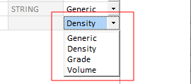
Field Classifications
Data file field definitions (and user-defined wireframe attribute definitions) can now be extended to include one of the following classifications:
-
Generic (the default)
-
Density
-
Grade
-
Volume
Classification allows the fields in a file to be ordered, grouped or filtered based upon a particular classification value. Fields classified as Density, for example, might be included in the calculation of weight graded averages.
XYZ Tile Image Server Support
The setup and display of an image using XYZ tile services, such as OpenStreetMap, MapBox and MapQuest, is now supported. Output images are saved with a .mmxyz file extension. The feature also supports a Maximum Zoom Level which sets the zoom level that can be applied without the tile images being redrawn.
Note: To connect to servers that are not open source, you will need to acquire a valid licence for usage.
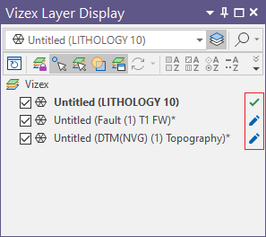
Wireframe Upload Status
Wireframe shapes in the Vizex Layers Display pane now display their Nexus .tridb file upload status.
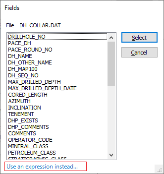
File Sorting by Expression
File Sorting in the File Editor and on the File | Edit Data ribbon now supports the use of expressions to select key fields.
Error Indicators
Error message indicators and input boxes with a red border now provide an indication of missing or invalid project parameters on the New Project and Attach Project backstage pages. Project names and file paths, for example, must not be empty or contain invalid characters.