Local Grid
Local grids are often used in areas of limited extent (e.g. a mine or project area).
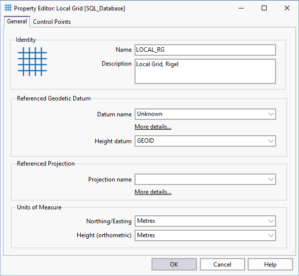
You can define a local grid by entering the local grid and UTM coordinates of two points on opposite corners of the local grid area.
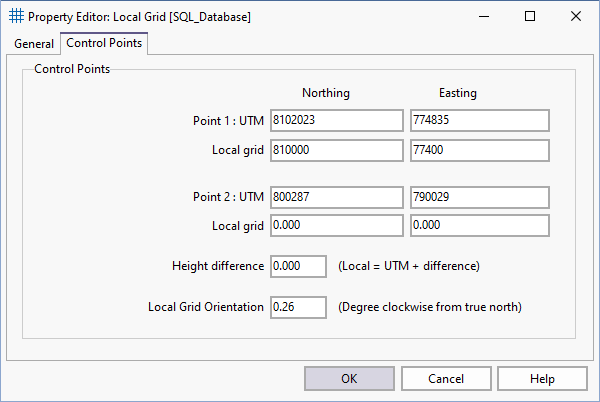
Micromine Geobank uses the two common points to determine translation parameters for coordinate conversions between the local grid and the specified UTM projection.