Core Features
This
Improved Local Grid Configuration
The following additions and improvements have been made to the configuration of Local Grids in the Coordinate Systems Editor.
-
The 'Local Grid Orientation' option has been added to the Property Editor: Local Grid form to enable the configuration of degrees clockwise from true north for a Local Grid.
-
The Heigh Datum drop down has been added to the General tab to select the applicable height datum for the local grid - GEOID (Default) or SPHEROID.
-
Control points have been moved to a dedicated tab to save space.
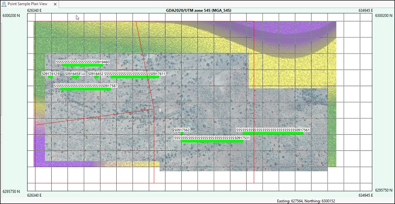
Show Background Image
The Show Background Image option has been added to both the Plan View configuration and ribbon. The option will display any saved georeferenced images configured for the Plan View.
The Transparency slider has also been added to enable adjustment of the transparency of the displayed image.
Language Installers
Standalone Language Pack installers are now provided so that translation updates can be made at a time other than when a new software release is available.
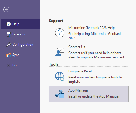
Update App Manager
In the backstage (File tab in ribbon) a button to 'Install or update the App Manager' has been added under Help - Tools. This will only show as enabled for Admin users.
Job Scheduler Active Computers
An 'Active' switch has been added to the list of Computers in the Job Scheduler. This allows a computer to be set to 'inactive' when a connection to it cannot be made. This avoids delays and errors when connection attempts are being made.
Plan View Images Folder
The Plan View tab and the Plan View Images Folder option has been added to the Options form. The new option is used to set the location of the georeferenced images for use as background images in the Plan Views on your system.
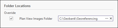
When working with georeferenced images to display in Plan View, images can be organised into subfolders which can be specified when a Plan View is configured. This is recommended if you have images from multiple Coordinate Reference Systems.
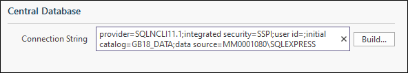
Sync Central Database
The Sync tab and the Connection String option has been added to the Options form. The new option is used to configure the connection to the destination database for the Synchronise functionality for Coal Field Geologists.
The definition of a sync operation is used when a link is established to a periphery device. To change an operation, duplicate it to create a new version. Connected devices can then disconnect from the old and connect to the new version.
The sync process within Micromine Geobank for Coal Field Geologists (Beta) uses the Microsoft® Sync framework. The Online Help provides guidance on the process which should be followed to ensure the transfer of data occurs as expected. See Working with Microsoft® Sync Framework.
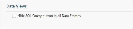
Hide SQL Query Button
An option has been added to Configuration Manager | Settings which allows administrators to hide the 'SQL Query' button in Data Views. This option is useful for sites where access to the SQL Query must be removed for security reasons.